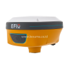
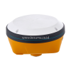
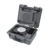
EFIX C5 IMU GNSS GEODETIC
PERFECT BASE OR ROVER :
Integration of Industrial art ad advanced technologies. 1008 channesl, full star satelite tracking, first-tier IMU, full GNSS support, all in the palm size.
VERSATILE, RUGGED, ACCURATE
- 100% more efficient to do surveying and staking-out
- 41% better performance in canopy environments
- Lifetime online face-to-face services
- Much easier RTK operations
- Enhanced signals tracking
- One click to all functions
- Comprehensice staking out
- Super accuracy
- connections in seconds
- cloud based management
100% MORE EFFICIENT TO DO SURVEYING AND STAKING-OUT
- 1008 channels, full support of all GNSS constellations.
- Advanced Full Start technology, to maximize the use of all the satellite signals.
- 4D IMU
- RTK keeping technology, maintain fixed positioning when real-time corrections are lost.
MEASURE ANYWHERE, WHEN YOU GET THERE
Double check technology, using mulit-frequencys to solve GNSS signal, smart select
- GNSS-IMU tight couping, using one epoch to get fix ambiguity
- 41% performance improvement
RTK CAN BE MUCH EASIER
- Cable free, Bluetooth radio, work without complex connections.
- Cloud-based data management
- One click to all functions Userfriendly interface, make it easy to understand and use; Supermenu, one click to access all functions.
- Staking-out from CAD basemap click to select the points to stake.
- Data sharing by bar code scanning.
FACE-TO-FACE ASSISTANCE, AND UNLIMITED TRAINING REMOTE ONLINE SERVICE BY ONE CLICK, TO GET INSTANT SUPPORT.
For full specifications, please refer to Download Brochure :
 Download Brochure
Categories: GNSS RECEIVER, GNSS SURVEYING
Tags: 3D Mapping, Aerial Surveying, alat survey gps geodetik, alat ukur survey dan pemetaan, autolevel, Automatic LeLidar, AUTOMATIC LEVEL, CHC, CHC i50, chc i73, CHC NAVIGATION, CHCNAV, chcnav_i73, Compas, Construction Surveying, Digital Elevation Model (DEM), DISTRIBUTOR LEICA, distributor leica total station, distributor resmi alat survey, efix, efix c5, FLEXLINE, FLEXLINE TS03, Geodetic Survey, Geospatial Data, GIS, gnss receiver, GPS GEODETIC, GPS GEODETIC CHCNAV i50, gps geodetic efix, gps geodetik, gps geodetik efix, hi-target, i73, IMU, imu rtk, indonesia, indosurta, indosurta group, kesuma, Land Surveying, LEICA, LEICA FLEXLINE, LEICA FLEXLINE TS03, leica geosystems, LEICA MS60, LEICA NOVA, LEICA NOVA MS60, LEICA TS-03, LEICA TS03, leica_geosystems_indonesia, Li-DAR, LiDAR, mapping, MS60, MULTI STATION, Multistation, NIKON, Orthophoto, Photogrammetry, Point Cloud, pusat alat survey, PUSAT TOTAL STATION, pusat_alat_survey, Remote Sensing, Robotic Total Station, RTK, SOKKIA, SPECTRA, surveying instruments, Suunto, THEODOLITE, TOPCON, topcon gnss receiver, Topographic Survey, TOTAL STATION, TOTAL STATION LEICA, TOTAL STATION LEICA TS-03, TOTAL STATION LEICA TS03, Trimble, TS-03, ts02, TS03, UAV

